Early Iron in the Eastern Rhenish Slate Mountains: the Siegerland
Contacts: Prof. Dr. Thomas Stöllner & Dr. Jennifer Garner & Stephanie Menic M.A.
thomas.stoellner@rub.de
jennifer.garner@bergbaumuseum.de
Stephanie.Menic@ruhr-uni-bochum.de
The Siegerland is one of the important German mining landscapes which ensured the supply of iron during the modern period of industrialization. Far less known is the prehistoric significance of the Siegerland: in the second half of the 1st millennium BC the region seems to have been one of the major iron suppliers of the Central German Uplands. The basis for this mining landscape is the world’s largest siderite (spathic iron) deposit in the Siegerland-Wied district. The manganese-rich weathering products of the siderite are present over wide areas and close to the surface on the summits of the mountain region and their bordering areas.

Fig. 01: Area of the excavation.
High Level of Technical Specialization
The Siegerland iron industry probably began in the 6th century BC. It appears that more people began to enter the region from the 4th century, and even more from the 3rd century BC. Previous research interpreted this development as a push to colonize new land in the mountains, however this does not altogether make sense. Unlike the favourable locations in the surrounding area, such as the West Hessian Lowlands or the Middle Rhine Valley, the Siegerland is not a suitable location for agriculture. What is uncertain is how and when the regional iron industry with its high level of technical specialization developed. The entire economic cycle of the Siegerland iron industry is as yet unexplored: did the areas of production shift over time? Was production seasonal, or was there a constant process of settlement? What strategies were pursued in local agriculture, and was the forest used systematically? What was the supra-regional significance of steel production?
Fig. 02: Excavation area Gerhardsseifen.
Reconstructing the Iron Age Mining Landscape
After initial excavations by G. Weisgerber 30 years ago, we have been investigating the former Siegerland mining landscape, in collaboration with LWL-Archäologie (Olpe branch), since 2002. The work has led to a project funded by the German Research Foundation (DFG), carried out with the Archaeology Department of the Ruhr University in Bochum since 2009.We systematically visit established mining find spots and have also discovered hundreds of new sites from all periods. More detailed studies have been carried out using combinations of prospection methods such as geophysical measurements, soil probe prospection and sondages. The aim is to reconstruct the Iron Age mining landscape and trace the production chain from ore extraction to smelting to the finishing and exporting of the steel products.
Archaeometallurgical prospections explore the various deposits in the work area. Together with analyses of the composition of the slag and of the elements contained in artefacts, they retrace the path taken by the ore from the deposit to the final product.

Fig. 03: Geomagnetic survey.
Large-scale excavations have taken place at the smelter site at the source of the Trüllesseifen (Siegen-Oberschelden) and since 2009 at the Gerhardsseifen smelter site (Siegen-Niederschelden). In addition to this, we have carried out numerous smaller sondages throughout the work area, in order to give a more detailed characterization of the smelter, forge, and settlement sites. For example, we want to clarify aspects of the extent and efficiency of Iron Age smelting, and answer previously unresolved questions on the shape and construction of the regional smelting furnaces.
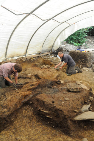
Fig. 04: Excavation at Gerhardsseifen.
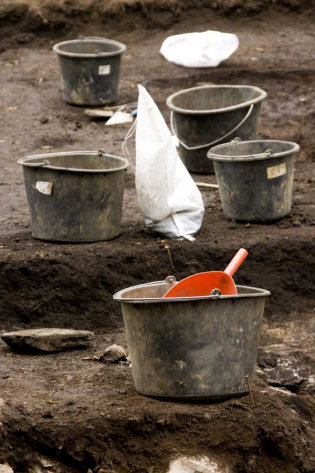
Fig. 05: Excavation at Gerhardsseifen.