GEOGRAPHY
The Perm region is located on the western part of the central Ural mountains. Tt borders on the Sverdlovsk region toward the east, the Komi Republic toward the north, Udmurtia and the Kirov region toward the west and the Bashkirian Republic to the south. Its surface is equal to appr. 160,600 km². The longest river of the region is the Kama with 1,805 km in length. It is the longest tributary of the Volga. The landscape forms the transitional zone between the Russian plain and the Ural mountains, containing flatlands (along the Kama), hills (west of the city of Perm) and mountains (reaching up to 1,469 m in the East). Over 60% of the region's surface is covered by mixed and decidious forests.
The region around Perm is a part of the temperate continental zone. The average temperatures are equal to -15° C to -18° C in January, and 16° C to 18° C in July. On average, there are 450-800 mm of precipitation per year.
The population of the Perm region exceed 3 million inhabitants (3,009,400, according to a census of 1996). 76.6% of the population lives in urban areas. The largest ethnic group is formed by the Russians (83.9%). An originally Finno-Ugric minority (appr. 4%) populates the North-West of the region (the Komi-Permyak Autonomic Region). Other minorities includes the Tatars (4.9%), the Bashkirs (1.7%) and the Udmurts (1.1%).
Like the entire Ural, the Perm region is famous for its rich resources of coal, gold, diamonds, salt, mineral oil and earth gas. Thus, the region is dominated by heavy industry such as the mining and processing of mineral resources, and machine construction as well as chemical and petrochemical industries. Agriculture in the Perm region is dominated by milk production, the breeding of cattle, goats and sheep as well as grain-production (rye, wheat, barley and oats).
Michael Orawski
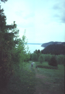
A landscape on the Kama